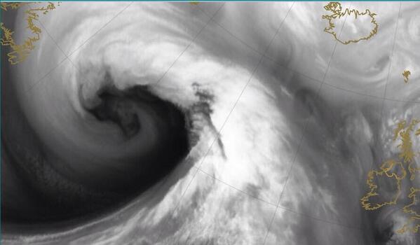
JOE used to go out with a girl called Christine but we don’t remember her being quite as angry, or as windy for that matter, as the latest storm to hit our shores.
Say hello to Storm ‘Christine:’
Met Éireann must be running out of Orange Warnings at this stage as they have issued yet another one this morning.
According to the Met Éireann website, this most recent status update means that there will be “widespread gales continuing today with gusts ranging 90 to 120km/h and very high Atlantic waves causing some coastal flooding. Passing heavy showers also with thunderstorms in places and local flooding inland. Sunny spells also. Highest temperatures 8 to 10 degrees.”
And, as if you needed any more proof of the incredibly stormy and dangerous conditions out there, just check out this picture from Brendan St John in Tramore, Waterford, which was tweeted by BBC journalist, Barra Best:
Not a good night for a midnight stroll in Tramore, County Waterford. Photo taken by Brendan St John #stormireland pic.twitter.com/gM5VKBkVsr
— Barra Best (@barrabest) January 6, 2014
Cork also seems to have been hit particularly bad this morning as this image of Wandesford Quay clearly shows:
Parts of Cork are starting to flood. This is Wandesford Quay. Photo by @theamazinghayes #stormireland pic.twitter.com/zDT5Dvd7Qc
— Barra Best (@barrabest) January 6, 2014
Here at JOE.ie we’ll keep you up to date on the current weather situation and you can also check out a five-day-forecast over on Met.ie as well as any traffic updates from AA Roadwatch.
Warning via Met Éireann
LISTEN: You Must Be Jokin’ podcast – listen to the latest episode now!