As of Wednesday, there are 12,547 confirmed cases of Covid-19 in the Republic of Ireland.
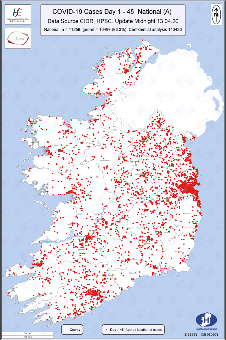
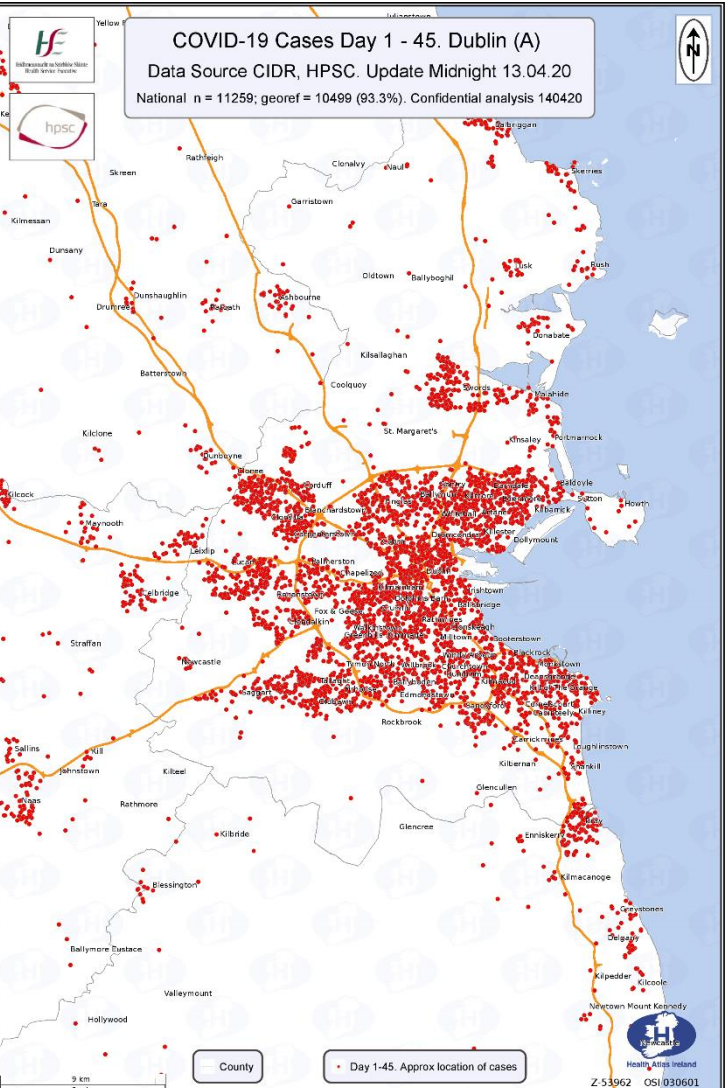
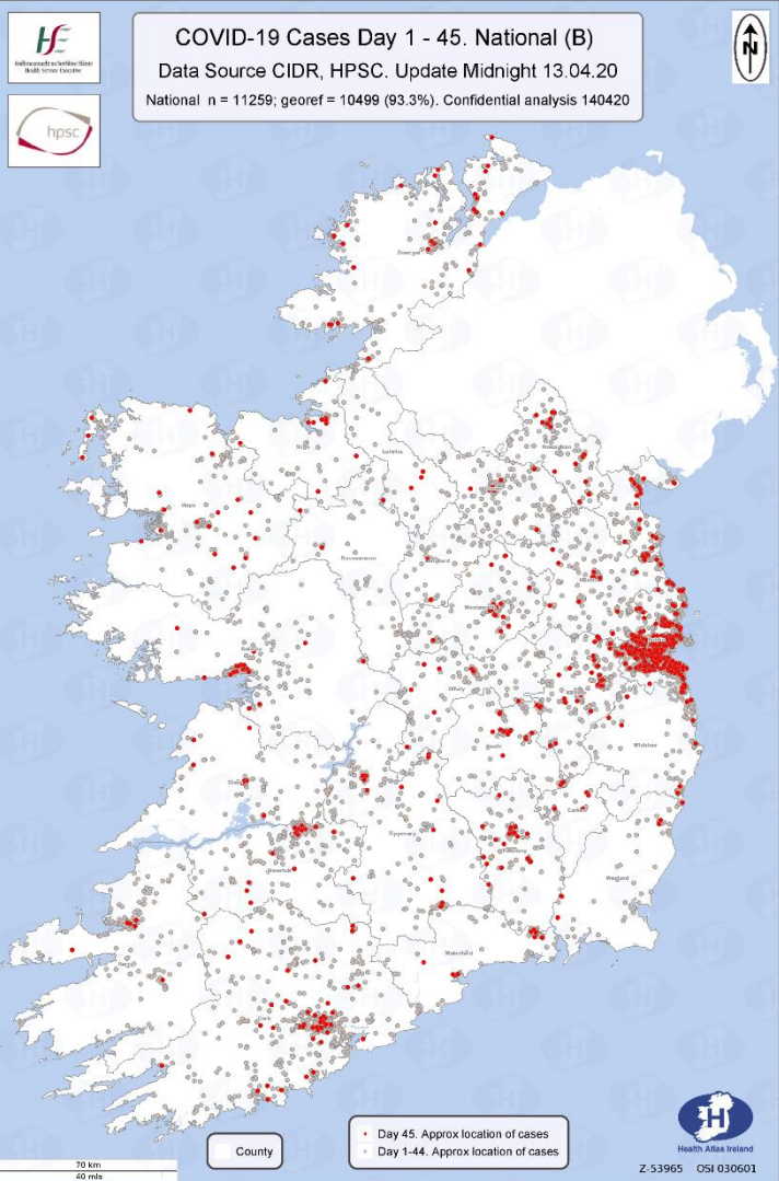
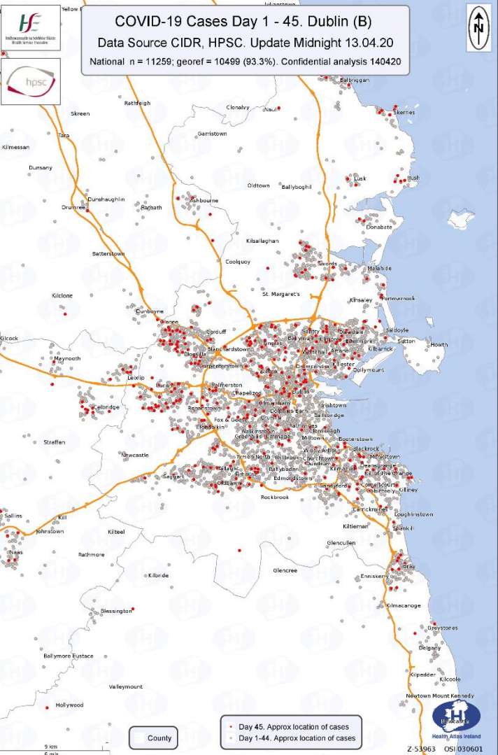
A map supplied by the Health Service Executive (HSE) outlines the exact location of all confirmed cases of Covid-19 in the Republic of Ireland.
The maps below, sourced with data from the Health Protection Surveillance Centre’s Computerised Infectious Disease Reporting (CIDR), represent the number of confirmed cases from midnight on Sunday (13 April), when there were a total of 9,655 confirmed cases of Covid-19 in Ireland.
The number of confirmed cases by county as of Monday, 13 April, can be accessed here.
Nationwide
Greater Dublin Area
Confirmed cases of Covid-19 on 13 April (including previous 24 hours) – Nationwide
Confirmed cases of Covid-19 on 13 April (including previous 24 hours) – Greater Dublin Area
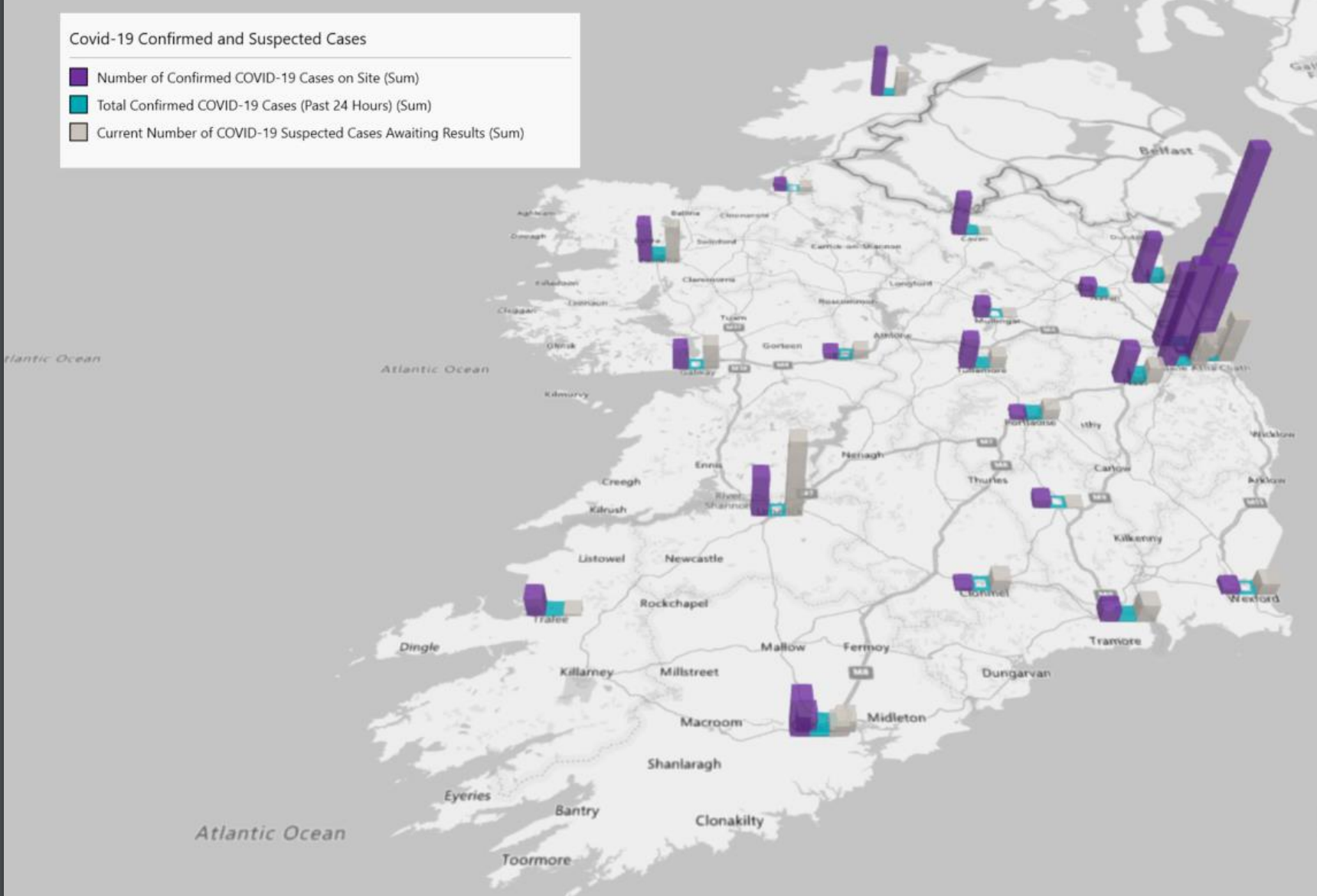
The map below, meanwhile, represents the geographical spread of confirmed Covid-19 cases and suspected cases at acute hospital sites across the country as of 8pm on Wednesday, 15 April.
On Wednesday, the Department of Health confirmed 38 further deaths from Covid-19 in the Republic of Ireland, bringing the total number of deaths to 444.
1,068 new cases of Covid-19 were confirmed in the Republic of Ireland, the highest daily total so far. 657 of the new cases came from Irish labs, while 411 (older cases) were recorded in labs in Germany.
Figures released on Wednesday confirmed there were six additional deaths from Covid-19 in Northern Ireland, bringing the total number of deaths to 140.
121 new cases of Covid-19 were confirmed in Northern Ireland on Wednesday; the total number of confirmed cases now stands at 2,088, with 13,672 individuals tested.
LISTEN: You Must Be Jokin’ with Aideen McQueen – Faith healers, Coolock craic and Gigging as Gaeilge
