


News
Share
Published 15:23 11 Jan 2024 GMT
Updated 10:49 12 Jan 2024 GMT

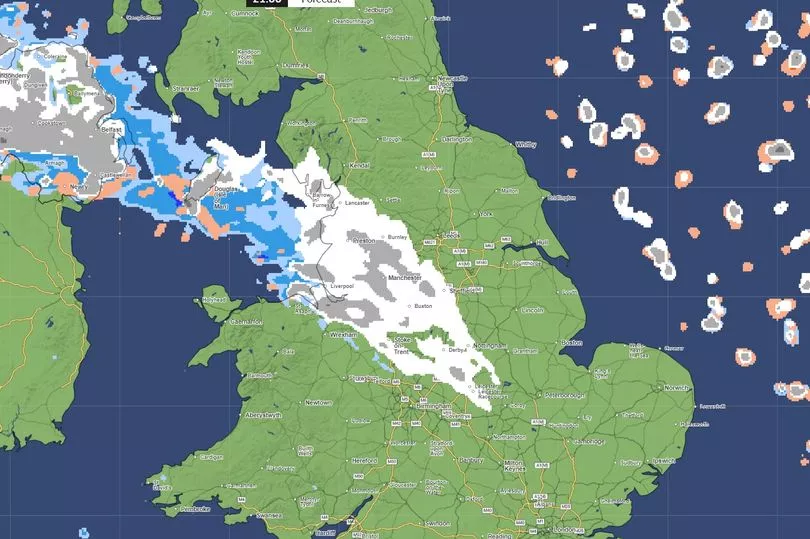
"It could be a juicy one." he introduced his video, "especially if you're interested in snow."Interestingly, he showed the difference between European and American weather tracking charts. There were slight discrepancies in the American [Global Forecast System - GFS] and European [European Centre for Medium-Range Weather Forecasts - ECMWF] models but both seemed in agreement that snow was likely in the middle of next week. Northern Ireland may experience the heaviest dusting but it will be noticeably cooler across the entire island. In the image [below] the * indicates snowfall - Dublin is included here, next Wednesday [Jan 17].
 https://twitter.com/metoffice/status/1745120817753559059
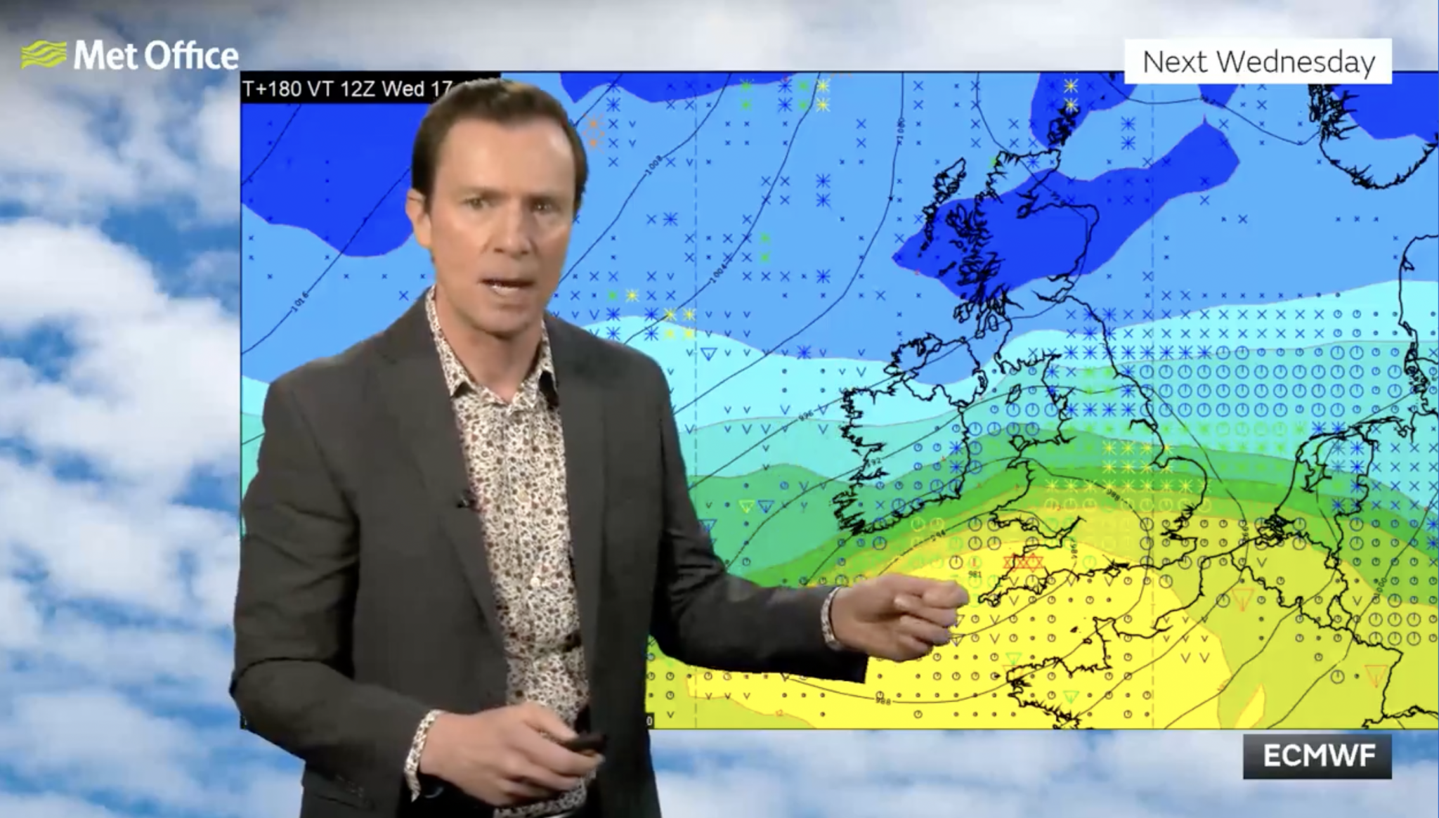
Met Office meteorologist Aidan McGivern said: “A cold front from the north towards the weekend will mark another change in the airmass for the UK, moving from something with a bit of an Atlantic influence to air that comes more directly from the Arctic.”
He continued: “We start with a northerly airflow and snow showers, especially near the coasts in the north. But there will also be brighter skies for some. Then, from the middle of next week, low pressure tries to move in from the South West, and the impact of this is still a bit uncertain at this range.
“Different models are saying different things in terms of the track of this low, but you have the ingredients for snow with cold air in place and additional moisture supplied from the Atlantic, which will bring rain, but on the boundary with the cold air, you could see some snow.”
https://twitter.com/metoffice/status/1745120817753559059
Met Office meteorologist Aidan McGivern said: “A cold front from the north towards the weekend will mark another change in the airmass for the UK, moving from something with a bit of an Atlantic influence to air that comes more directly from the Arctic.”
He continued: “We start with a northerly airflow and snow showers, especially near the coasts in the north. But there will also be brighter skies for some. Then, from the middle of next week, low pressure tries to move in from the South West, and the impact of this is still a bit uncertain at this range.
“Different models are saying different things in terms of the track of this low, but you have the ingredients for snow with cold air in place and additional moisture supplied from the Atlantic, which will bring rain, but on the boundary with the cold air, you could see some snow.”
Explore more on these topics:

News

News

News

News

News

News


