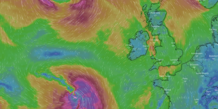
Storm Callum is expected to hit on Thursday night.
The National Emergency Coordination Group (NECG) is meeting at 3pm on Thursday to prepare for the arrival of Storm Callum.
It’s believed they will discuss the possibility that it will be unsafe for some schools to open on Friday morning.
The NECG includes representatives from Met Éireann, local authorities, the ESB, Office of Public Works and the government who will discuss the best course of action as the storm hits Ireland on Thursday night and Friday morning.
We’ll know more about the plans after 3pm today.
Met Éireann issued a status orange wind warning for 13 counties on Wednesday evening with the warning active from 10pm on Thursday until 1pm on Friday in some areas.
Along with strong winds which could top 130km/h, there will also be heavy rain and high tides. Aside from this, there’s also a risk of coastal flooding and damage in the counties affected by the warnings.
Coastal counties in particular are advised to be prepared for high winds, which will hit harder there than in other inland areas.
The OPW also urged people to take care due to the potential threat of dangerous weather.
In a statement, the OPW said: “With various severe wind and rain conditions pending toward the end of this week, it is important for everyone to keep a close watch on the changing weather conditions and specifically the warnings being issued by Met Éireann over the coming days. Please take heed and stay safe.”
In other areas, preventative measures are being taken ahead of Callum’s arrival with RTÉ reporting that Galway City Council is installing a 80m portable dam at Spanish Arch and flood gates at various points in Salthill.
LISTEN: You Must Be Jokin’ with Aideen McQueen – Faith healers, Coolock craic and Gigging as Gaeilge


