The fires are clearly visible…
Efforts are on-going around Ireland to try and stop the spread of a number of gorse fires.
The largest of these is in Cloosh Valley, Galway where a fire has already destroyed 1,500 hectares of forest and around 2,000 hectares of bogland in the county. Overall, an area around five times the size of Phoenix Park was ablaze.
NASA released an aerial photo of Ireland recently and in the photo, some of the gorse fires burning around Ireland are clearly visible.
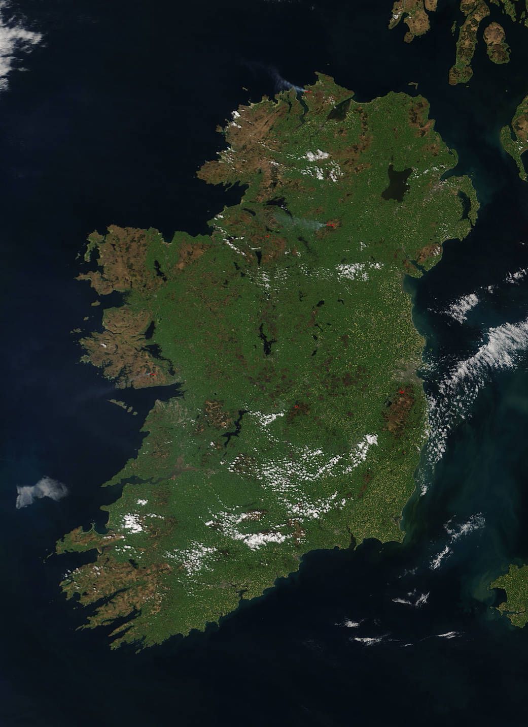
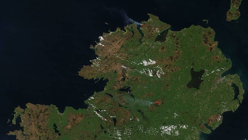
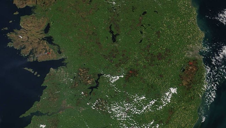
NASA said: “This natural-color satellite image was collected by the Moderate Resolution Imaging Spectroradiometer (MODIS) aboard the Terra satellite on May 08, 2017. Actively burning areas, detected by MODIS’s thermal bands, are outlined in red.”
Earlier today, the HSE issued a warning to people about the health risks surrounding the smoke from gorse fires.
In a statement they said: “In light of recent gorse fires in the west of Ireland, please avoid spending long amounst of time outdoors in areas affected by any smoke or ash.
“For the latest updates and additional information on the fire and weather conditions in your area, please regularly listen to local and national radio. Smoke levels will change depending on wind conditions so please use personal judgement.”
LISTEN: You Must Be Jokin’ with Aideen McQueen – Faith healers, Coolock craic and Gigging as Gaeilge