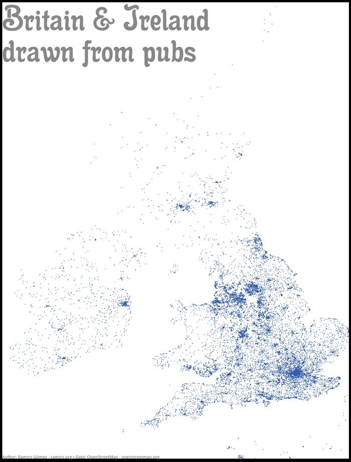
Looking good, Ireland.
An experiment to see if a pub map would accurately line the the shape of a country was the brainwave musings of Ramiro Gómez and it has provided some pretty interesting results.
This map of Ireland and England looks spectacularly accurate from the pub locations littered across the two islands.
They look like star-studded replicas of their true selves as Berlin data explorer Gómez used OpenStreetMap to configure the drawing.
It seems Ireland’s love for pints and port stretches from Mizen to Malin head and everywhere in between, with particularly strong pub groupings across Dublin and Cork.
It’s amazing what technology can tell you these days, although we probably all knew the country was covered in pubs already.
Look! We can see our pub from here! (Click on the map for a bigger image.)
Hat-tip to i100
LISTEN: You Must Be Jokin’ with Aideen McQueen – Faith healers, Coolock craic and Gigging as Gaeilge