Get ready for a blustery and “very showery” few days…
Sunday (15 May) was officially Ireland’s warmest day of the year so far, and we sincerely hope that you made the most out of every single second of it.
According to Met Éireann, one weather station in Roscommon hit as high as 20.9 degrees on Sunday afternoon, while several other stations in the west also reached over 20 degrees.
Having already shot down the prospect of a mini-heatwave earlier this month, the national forecaster has further bad news for us. In short, the week ahead looks quite grim. Let’s break it down, per the latest Met Éireann forecast:
Monday is already off to a suitably wet start with showery, sometimes heavy rain is expected in many areas. The rain will clear northwards through the morning and early afternoon, leading to sunny spells and scattered showers. Met Éireann warns of the possibility of localised thundery downpours, with an overall humid day ahead.
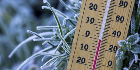
Highest daytime temperatures of 16 to 20 degrees are anticipated. Monday night, meanwhile, will be largely dry with clear spells to begin with. However, further showery rain will spread from the southwest overnight, becoming blustery and strong in the west and the north. Conditions will be mild enough, with lowest temperatures of 10 to 12 degrees.
A wet start this morning with showery rain☔️ in many areas, heavy in places with the potential for localised thundery downpours⛈️.
Through the morning and early afternoon, the rain will clear northwards to sunny spells and scattered showers🌦️.
Highs🌡️ of 16 to 20 degrees. pic.twitter.com/AjVk9o5xVz
— Met Éireann (@MetEireann) May 16, 2022
Tuesday will see outbreaks of morning rain clearing northwards only to be replaced by – wait for it – another spell of rain, following from the south. This burst will become “widespread and heavy” throughout the afternoon, particularly in the east of the country. The west, in contrast, will have more showery conditions along with some sunny spells. Highest temperatures of 14 to 17 degrees are forecast.
Tuesday night brings more showers or longer spells of rain along with breezy or windy conditions, the most blustery of which will be found near the west coast. Lowest temperatures of 7 to 10 degrees.
Wednesday morning will be largely dry with sunny spells and “just a few” showers, so that’s something at least. Don’t get too comfortable, though, as rain will once again spread northwards across the country through the afternoon and into the evening with heavy downpours possible. Highest daytime temperatures of 14 to 18 degrees.
By nightfall, the rain will finally ease off, with clear spells developing. Mist and fog patches should form as a result, along with lowest temperatures of 6 to 8 degrees.
Thursday brings a mix of sunny spells and scattered showers, the latter of which will be most frequent and occasionally heavy over the western half of the country. However – and here’s the good bit, finally – Met Éireann says “there will be a good deal of dry weather overall”. Highest temperatures of 14 to 18 degrees are anticipated.
As for the weekend, the early outlook is… not great, sorry. Friday will be “very showery” with strong winds and temperatures around the mid-teens. Saturday will feature sunshine and scattered showers, while Sunday should prove “drier and a little warmer” as conditions ease just in time to end the weekend. Yay?
LISTEN: You Must Be Jokin’ with Aideen McQueen – Faith healers, Coolock craic and Gigging as Gaeilge