Geography lesson needed.
We understand that Ireland is not the largest country in the world and we are but a small island sitting in the Atlantic on the western coast of Europe.
But we didn't realise that other people thought Ireland was
quite this small...
Newquay is a town on the north coast of Cornwall, in southwest England and
it has a tourism website dedicated to encouraging people to visit the area.
It has been voted one of the UK's favourite seaside towns, with some lovely beaches and is known as a great family holiday destination.
So in a bid to highlight how accessible the town is for tourists, a website provides a handy little map of the destinations that fly to the area.
This is the map they use...
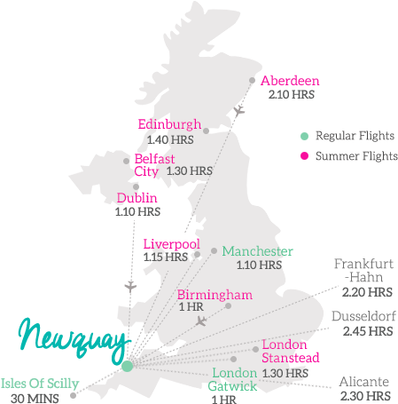
Now, we're no experts in geography, but something about this seems a little bit off when it comes to the map of Ireland and the placement of Dublin.
We can't quite put our finger on it though...


