Let it snow.
Switch to a different calendar for the League of Ireland season. Summer football will be grand, it will get the fans out.
Granted, we’re a long way off from summer but three rounds of fixtures into the 2020 League of Ireland and games have already been called off. Aside from this, Bohs vs Shamrock Rovers on the opening weekend was deemed to be too windy and treacherous for RTÉ to even televise.
Well, as for tonight’s batch of fixtures, here’s the scene from Ballybofey, Donegal.
🎵Do you want to build a snowman?🎶⛄️🔵⚪️@FinnHarpsFC pic.twitter.com/HchPyZcnni
— Kathy Taaffe (@kdtaaffe) February 24, 2020
Yeah, you can see why Finn Harps vs Shelbourne was called off.
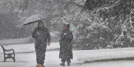
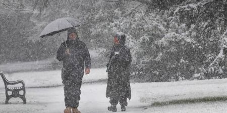
The sneachta has already arrived in certain parts of the country and Met Éireann has issued a status yellow snow and ice warning for Ireland.
In terms of the warning, they’ve stated that “wintry showers, mainly of hail and sleet, will become increasingly widespread during Tuesday leading to icy patches. Some snow accumulations will also occur.”
The warning is in place from 6am on Tuesday 25 February to 9am on Wednesday 26 February.
Snow/ice warning issued
Status: Yellow
Location: countrywide
Valid: 6am Tuesday morning to 9am Wednesday morningFor full warning info please see https://t.co/oOxITrsnvw pic.twitter.com/d9sgi58T0k
— Met Éireann (@MetEireann) February 24, 2020
As for the general forecast, the mercury is set to drop on Monday night with cold spells and scattered showers throughout, most of the showers on the western coast. The showers will become increasingly wintry as the night progresses, with a mix of hail, sleet and hill snow. There is also a risk of thunder, mainly in Atlantic coastal counties.
The risk of sleet and snow will be prevalent throughout this week, especially in Ulster and Connacht.
Tuesday is shaping up to be a cold and windy day, with sunny spells and widespread blustery showers. Some of the showers are expected to be a wintry mix of hail and sleet, with a risk of some snow showers, mainly over high ground. There is also a risk of thunder too. Joy.
Tuesday night will see scattered showers in the western half of the country and some will be wintry. Basically, expect plenty of hail, sleet and snow. Yet again, there is also a risk of thunder.
Wednesday is set to be a bright day with sunny spells, but scattered showers also. Some hail and sleet, with a continuing risk of snow showers are expected to fall, mainly over high ground.
Wednesday night is set to be very cold overnight, with sharp or severe frost. Yet again, some wintry showers will occur, mainly in the northwest.
Looking further into the week, Thursday night is set to see outbreaks of rain extending from the Atlantic, possibly falling as sleet and hill snow, in the north and northwest. As for Munster and south Leinster, it’s set to be very patchy.
This period of cold and unsettled weather is set to continue right up until the end of the week and the weekend, with a risk of further wintry showers.
All in all, snow, sleet, and rain for a lot of the country.
February, it has been rotten. Please leave.
LISTEN: You Must Be Jokin’ with Aideen McQueen – Faith healers, Coolock craic and Gigging as Gaeilge